
National Parks / Forest
Home to 4 National Parks and the Only National Forest in Tennessee.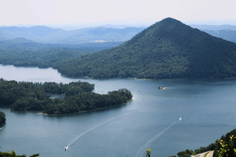
Cherokee National Forest
The Cherokee National Forest is divided into northern and southern sections by the Great Smoky Mountains National Park. The 650,000-acre forest is the largest tract of public land in Tennessee and adjoins other national forests in Virginia, North Carolina and Georgia. The forest is home to 30 developed campgrounds and numerous picnic areas, over 700 miles of trails, whitewater rivers, and two scenic byways. Whether you’re seeking the thrill of whitewater rafting, the tranquility of a backcountry trail, or a peaceful night under the stars, you will find it here.
East Areas:
Pigeon River | French Broad River | Appalachian Trail
West Areas:
9 Lakes Region National Parks
The Great Smoky Mountains National Park is the most visited national park in the United States. Preserving the history of the Appalachian Mountains with the largest protected land area in the Eastern home to the natural wildlife, hundreds of miles of hiking trails and so much more. The Great Smoky Mountains National Park is free to everyone
Spanning over 125,000 acres, the Big South Fork National River and Recreation Area offers a captivating blend of natural beauty and historical significance. The Park is a haven for outdoor enthusiasts. For hikers and backpackers, the Sheltowee Trace is a 343-mile National Recreation Trail. The park also boasts sandstone arches, an IMBA cycling trail system, and equestrian paths for horseback riding.
The Cumberland Gap is a natural mountain pass connecting Kentucky and Tennessee. A footpath originally used by buffalo, Native Indian tribes, and long hunters, it was later used by explorers such as Thomas Walker, Joseph Martin, and Daniel Boone to expand the western frontiers. The Wilderness Road passed through the Gap providing pioneers a route from Virginia to Kentucky, serving as an important route for commerce and as a postal road. During the Civil War, this strategic location was occupied by both the North and South, changing hands several times. Moonshiners careened through the Gap along “Thunder Road.”
The Obed Wild and Scenic River is a premier destination for whitewater enthusiasts, offering 45 miles of exhilarating rapids ranging from Class II to Class IV. Located within the rugged terrain of the Cumberland Plateau, this river provides a thrilling experience for paddlers seeking both challenge and beauty.
In addition to its whitewater offerings, the Obed River is also a significant segment of the Cumberland Trail, a planned 300-mile footpath traversing the ridges of the Cumberland Plateau. This trail offers hikers unparalleled access to the region’s diverse ecosystems and breathtaking vistas.
In addition to its whitewater offerings, the Obed River is also a significant segment of the Cumberland Trail, a planned 300-mile footpath traversing the ridges of the Cumberland Plateau. This trail offers hikers unparalleled access to the region’s diverse ecosystems and breathtaking vistas.
With the hope of developing technology that would end World War II, the U.S. government built Oak Ridge under a cloak of great secrecy. When the Japanese attacked Pearl Harbor on Dec. 7, 1941, the city of Oak Ridge didn’t even exist. But in 1942, the U.S. Army Corps of Engineers purchased 59,000 acres of century-old family farms and small rural communities for a top-secret scientific mission to produce the world’s first atomic weapons, known as the Manhattan Project. The Park preserves the sites, facilities, equipment, artifacts, and stories associated with this the unprecedented top-secret project.